← Back
GNSS Spoofing in the Strait of Hormuz: Restoring Trust in Maritime Positioning

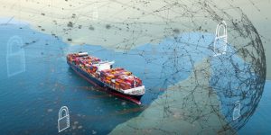
A growing threat in a critical maritime chokepoint
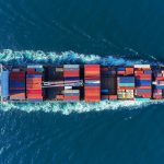
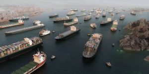
The Strait of Hormuz, located between Iran and the Arabian Peninsula, is one of the most strategic maritime routes in the world. Every day, a significant share of global energy flows passes through this narrow corridor.
However, a major shift is underway. GNSS spoofing in the Strait of Hormuz is no longer a theoretical risk, it is an operational reality.
Recent observations, including real vessel behaviors such as the Iron Maiden and Bogazici transits, show how ships are adapting to this degraded environment. As a result, vessels may appear in incorrect locations, while operators receive inconsistent or misleading data.
When GNSS spoofing disrupts maritime operations
GNSS spoofing consists of broadcasting false satellite signals, causing vessels to calculate incorrect positions.
In the Strait of Hormuz, this creates a gap between perceived and actual position. Vessels may unknowingly navigate based on false coordinates, increasing operational and compliance risks.
This degraded environment provides deception opportunities for vessels such as Iron Maiden or Bogazici to adapt their behavior during transit, combining navigation strategies with signal manipulation.
AIS manipulation in the Strait of Hormuz: Real-world use cases
 AIS manipulation often complements GNSS spoofing, as illustrated by recent vessel behaviors.
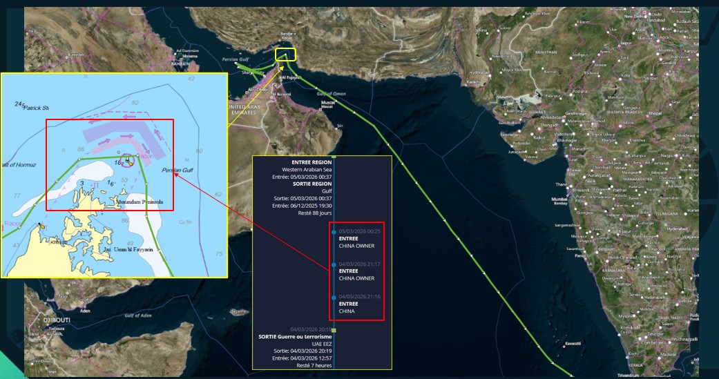
The bulk carrier Iron Maiden transited the Strait of Hormuz in March 2026. During its passage, it deviated from the traffic separation scheme, sailing closer to the UAE coast. At the same time, it briefly changed its AIS identity to “China owner” before restoring it outside the sensitive area .
Similarly, the vessel Bogazici adopted a comparable strategy. During its transit, it temporarily altered its AIS signal to “Muslim vsl Turkish”, before reverting to its original identity once outside the Strait .
These cases highlight a key evolution: AIS is no longer just a tracking tool, it has become a strategic layer of deception communication.
From signal manipulation to data uncertainty
The behaviors observed in Iron Maiden and Bogazici illustrate a broader trend.
Vessels no longer simply emit data, they actively manage how they appear. When AIS manipulation is combined with GNSS spoofing in the Strait of Hormuz, the result is a maritime picture that is only partially visible and potentially misleading.
Operators must now deal with uncertainty at 2 levels:
- what vessels transmit
- what vessels actually experience onboard
Rebuilding maritime awareness with GEOINT
To address GNSS spoofing in the Strait of Hormuz, CLS leverages advanced Geospatial Intelligence (GEOINT).
The approach relies on combining and fusing multiple data sources (AIS, SAR and optical imagery, RF detection and contextual maritime data), enriched by AI analytics and the expertise of CLS analysts.
This combination transforms heterogeneous data into a coherent, reliable and decision-ready maritime picture, even when signals are degraded or manipulated.
MAS: Detecting anomalies beyond AIS
The Maritime Awareness System (MAS) enables detection of abnormal behaviors such as those observed in Iron Maiden and Bogazici. By correlating AIS data with satellite observations, MAS identifies inconsistencies, route deviations and suspicious identity changes. MAS provides a real-time and reliable maritime picture, even in complex environments like the Strait of Hormuz.
VIGISAT: From detection to actionable intelligence
By combining multi-sensor data fusion, AI enrichment and 24/7 human expertise, VIGISAT transforms detections into true operational intelligence. CLS analysts contextualize anomalies, identify complex behavioral patterns and interpret cases such as Iron Maiden and Bogazici to understand the intent behind these strategies. This enables a shift from raw data to reliable, contextualized and actionable intelligence.
See how CLS reconstructs maritime reality beyond AIS:
RockFLEET Assured: Trusted positioning in GNSS-denied environments
 While GEOINT solutions reconstruct the maritime picture, vessels still face one key challenge: trusting their own position. RockFLEET Assured directly addresses GNSS spoofing in the Strait of Hormuz by providing independent, accurate and authenticated positioning.
In scenarios similar to Iron Maiden or Bogazici, where signal manipulation occurs, RockFLEET Assured allows crews to detect anomalies in real time and rely on trusted positioning data.
This restores confidence onboard, even in degraded navigation environments.
A complete approach to maritime security
GNSS spoofing in the Strait of Hormuz reflects a broader transformation of maritime risk. Signals can be manipulated. Positioning can be corrupted. Visibility can no longer be assumed. To deliver a complete maritime awareness capability, CLS addresses this challenge by combining:
- onboard trusted positioning
- global detection and analytics
- expert intelligence
From uncertainty to control
The Strait of Hormuz is now a degraded navigation environment where data integrity is critical. The examples of Iron Maiden and Bogazici clearly demonstrate how vessel behavior is evolving in response to GNSS spoofing and AIS manipulation. In this context, value no longer lies in data alone, but in the ability to correlate, validate and interpret it through a unique combination of advanced technologies and human expertise.
The challenge is no longer to see vessels. It is to understand what is real.
By bridging the gap between data and decision, from space to ship, CLS helps maritime stakeholders regain control and ensure safe, compliant and resilient operations, even in the most complex environments.
Secure your maritime operations in degraded environments.