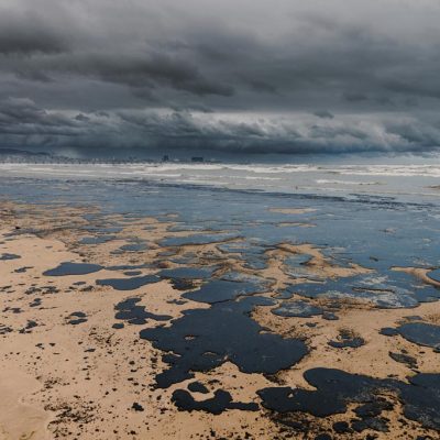
Oil Spill Monitoring
A Proven Solution to Detect and Monitor Oil Pollution at SeaAccidental or from illegal discharge, oil spills require rapid response to avoid massive spread at sea and mitigate dramatic impacts on marine environments.
CLS helps you detect and identify oil spills, calculate their drifts and potential polluters for immediate response, monitoring and support contingencies.
We rely on a Complete Service Chain to Monitor Oil Pollution
Radar satellite imagery, a proven technology to identify oil slicks
Dedicated interface for analysis, drift modelling and polluter identification

The MAR-GE/T floatable beacon for in-situ pollution tracking


MARGE/T
Floatable Drifter for In-Situ Pollution Tracking
Simply place the MAR-GE/T beacon on the surface of the oil slick and let it drift for in-situ measurement and monitoring of the pollution, as it is equipped with a GPS data logger reporting up to 96 daily accurate positions.
This easy-to-use drifting floatable beacon provides global satellite coverage and geofencing services through the Argos satellites network.
Latest News
Probabilistic Oil Spill Modeling for Emergency Response
Marine oil spill incidents at sea represent a major challenge for maritime safety and environmental protection. In emergency situations, authorities and response teams operating in marine and...

Satellite Oil Spill Detection in Gabon: How CLS Supports Marine Pollution Investigations
Satellite oil spill detection in Gabon was requested after an environmental organisation reported a potential hydrocarbon slick offshore. CLS analysed the event using Sentinel-1 radar imagery and...
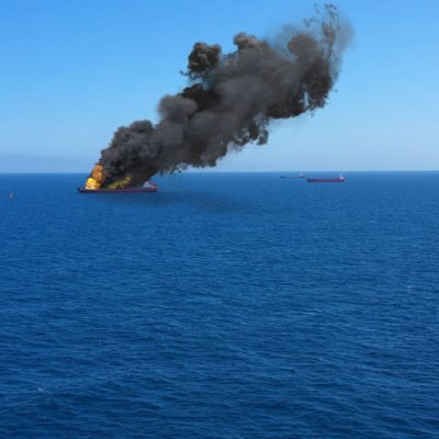
Collision Between Front Eagle and Adalynn: Satellite and AIS Analysis
Overview of the incident When the Front Eagle and the Adalynn collided near Khawr Fakkan in June 2025, the circumstances surrounding the impact were unclear. A fire broke out on board the Adalynn,...
Begin with CLS
How can we help you? CLS works with partners in all areas, both private and public, in charge of maritime surveillance. If you want to know how we can help you increase your performance, get in touch with our team.