← Back
Position: Iceberg hunter

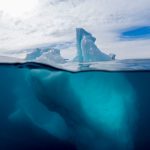
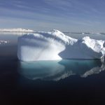
Icebergs represent the greatest risk to competitors of the Vendée Globe as they enter the next stretch of the race: the Southern Ocean. We spoke to Jimmy Viard, the CLS radar specialist who is tasked with monitoring icebergs in the area and advising the race organizers to ensure that contestants navigate safely through the area.

After proving himself as a skilled electronics technician in the French Submarine Forces, Jimmy decided to take on a new challenge and chose to join CLS, and more specifically the OperationsUnitof the CLS Maritime SurveillanceBusiness Unit.
Jimmy is passionate about the sea and VIGISAT, CLS’s dedicated satellite image acquisition and processing station, is based near the sea in Brest, France.
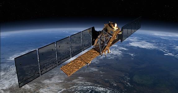
Sentinel-1 satellite. ESA
Each day CLS acquires and analyzes satellite imagery to support operations at sea, albeit for maritime safety and security, environmental protection, or to ensure the safety of competitors of the Vendée Globe Race, which is today’s mission. Jimmy, and CLS’ other radar analysts, monitor and scrutinize the ocean, using data from satellites that are in orbit several hundred kilometers above the earth.
For the 2020 Vendée Globe Race, no fewer than 300 satellite images are decrypted and analyzed by CLS during the race. More than a hundred icebergs are located, and their drift is calculated and communicated to the race management team to ensure the safety of competitors.
The Vendée Globe sailors are fond of breaking records, including the Jules Verne Trophy for the fastest navigation of the world. CLS’s Operations Unit is there to support them in the pursuit of their passion and to ensure their safety.
Related Posts:
 Preserving our Planet: Sri Lanka’s MEPA Turns to CLS to Deploy National Satellite-Based Oil Spill Detection Service
 CLS is attending MRST 2023 trade fair from 1st to 2nd February in London
 Vendée Globe 2024 Edition – Ice Risk: Monitoring Icebergs from Space
 Jules Verne Trophy: CLS detects dangerous icebergs via satellite