← Back
Search Area Evaluation with THEMIS SAR: The First Crucial Step in a Search and Rescue Operation

Search Area Evaluation (SAE) is one of the most important phases in the process of managing a SAR case in THEMIS SAR.
It helps SAR operators determine the best area to search for. The search area can be automatically calculated following an aeronautical and/or maritime drift of one or several objects, where the drift start time is basically the LKP* position(s) and the drift end time corresponds to the datum time, i.e., the time we are ready to start searching. Of course, several SAE models can be created to determine new search areas during the whole life of the operation.
All this process is driven by the IAMSAR* guidelines, calculating drift vectors based on weather and leeway data of the searched object(s), applying errors to calculate the total probable error of positions at the end of the drift and to draw the errors circles that will help determine the search area.
A particle model based on another drift methodology (called Monte Carlo particle model) is also available in THEMIS SAR. It allows the SAR operator to split the LKP into N particles where each of them is spread differently.
A specific model for every use-case
Depending on the SAR operation scenario, the operators may choose between 4 types of models:
- Datum Area: based on one LKP, the system calculates a drift between the LKP time and the Datum time,
- Datum Line: several points along a route are drifted, the system calculates a search area for each leg of the route (segments between waypoints),
- Backtrack: from a known position of a found object, the system calculates a backtrack drift to determine where the incident could have happened, and then run a forward drift to calculate a search area for another object(s),
- Manual: the SAR operator directly draws an ABCD rectangle of the map without any drift calculated.
Figure 1 Datum Area using IAMSAR drift model
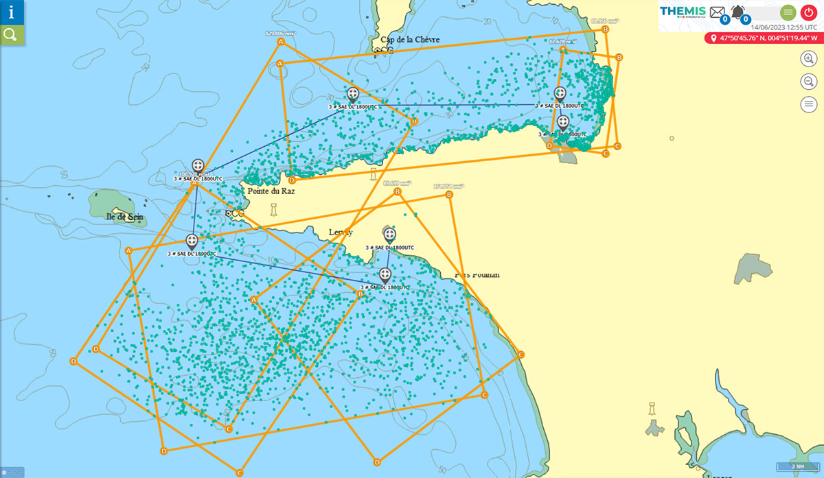
Figure 2 Datum Line using Particle Modelling
The system is compliant with a lot of positioning systems allowing to plot on the map the positions of surrounding vessels or aircrafts, in real-time.
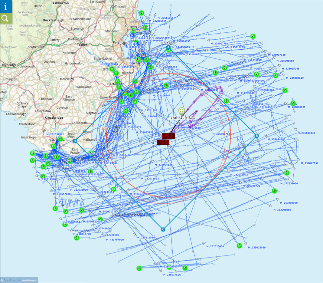
Figure 3 Real-time AIS traffic around a search area
Once the search area has been determined, the operator can allocate search units to the area.
This is the second phase of an operation that can be managed in THEMIS SAR, the Search Area Allocation phase (SAA). This will be the subject of a future article.
*LKP: Last Known Position
*IAMSAR: International Aeronautical and Maritime Search and Rescue
Related Posts:
 Security at Sea: CLS Strengthens its Position Through Pivotal Contracts in India, Sri Lanka and Thailand, and Acquires SAT ONE in Brazil
 Satellite Oil Spill Detection in Gabon: How CLS Supports Marine Pollution Investigations
 Discover MAS: Smart Data Fusion for Comprehensive Maritime Understanding
 Improving Papua New Guinea Fisheries with THEMIS SAR