← Back
With THEMIS SAR, We Help Organize and Manage Search and Rescue Operations

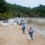
When a disaster occurs, the role of search and rescue teams becomes paramount in saving lives. Indeed, one of the major components of search and rescue is first the conduct of the search to locate and secure individuals.
To assist personnel who plan and coordinate SAR operations and exercises – Rescue Co-ordination Centers (RCCs) and Rescue Sub-centers (RSCs) – CLS has set up the THEMIS SAR solution, an incident management system for RCCs.
In a previous paper published on June 26, 2023, we spoke about Search Area Evaluation with THEMIS SAR, the first critical step to manage a search and rescue operation.
Today, we detail the importance of the Search Area Allocation (SAA) function, consisting essentially of calculating a search plan for Search & Rescue Units.
How to determine Search Area Allocation with THEMIS SAR?
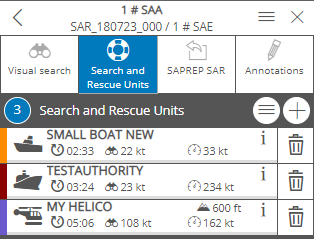
Three search units added to a SAA model
After calculating a SAE (Search Area Evaluation) model to determine a search area, RCCs operators can create Search Area Allocation (SAA) model through THEMIS SAR.
This major feature allows users to create a search plan for Search and Rescue Units (SRUs). The search units can be selected either from the SRU database, which you can manage directly into THEMIS, or from the surrounding vessels reporting AIS positions or other means of communications. Otherwise, “temporary – on-the-fly” search units can be added to the SAA models.
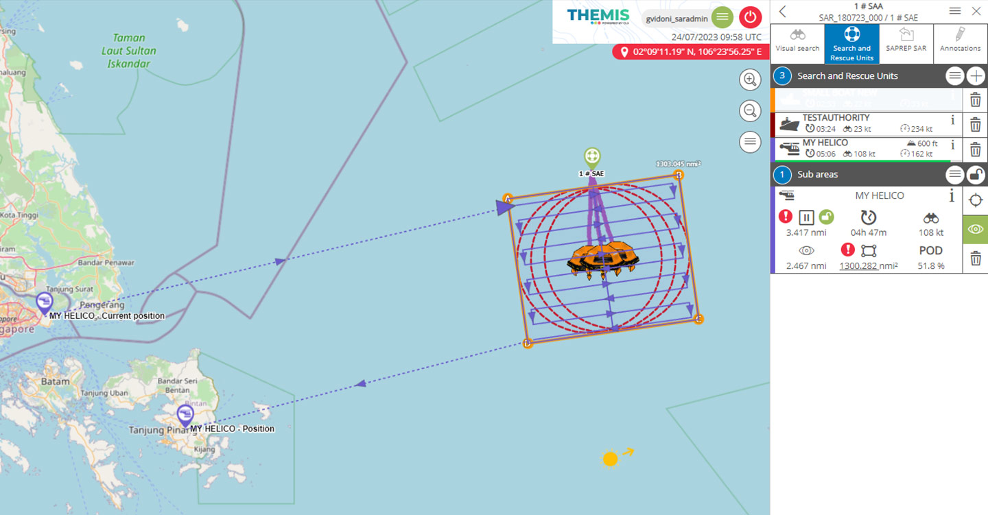
Next step is to allocate the search units to the search area
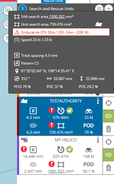
When a search unit is assigned, THEMIS determines the corrected sweep width based on the user’s inputs (search object, SRU type, visibility, altitude of the SRU, weather/fatigue correction factors, …) and uses by default a coverage factor of 1, meaning that the track spacing will be equal to the corrected sweep width. Based on speed and endurance entered by the user, the area covered by the SRU could be higher of lower than resultant SAE area.
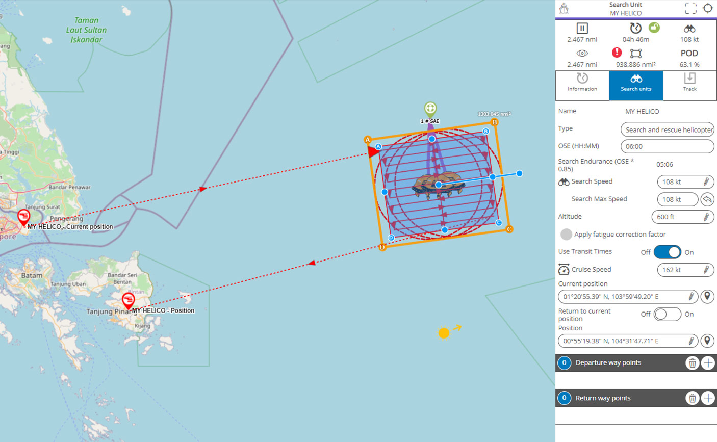
In the example above, the helicopter does not cover completely the SAE search area (orange rectangle). The operator may adjust the area covered by the helicopter by adapting either track spacing, endurance or search speed.
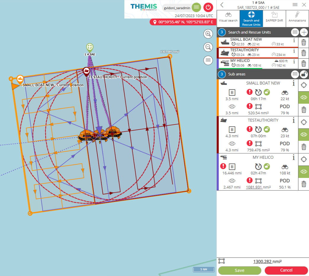
The different IAMSAR’s patterns can be used in THEMIS SAR. Example below shows the same area covered by three search units using different search patterns.
The solution can also calculate the probability maps for containment of the search object(s). The POC (Probability of Containment) is then calculated for the SRU based on the area covered. A POD (Probability of Detection), as well as a combined POD is also calculated.
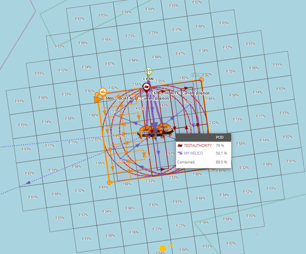
Finally, a POS (Probability of Success) of the operation is determined for all search units.
CLS collaborates closely with maritime stakeholders to deliver essential, actionable information for facilitating time-sensitive decision-making. With its exclusive access to global data, expertise in data integration and AI technologies, tailor-made solutions for each maritime entity, and internationally recognized technical proficiency, CLS serves as the ideal partner to meet your specific requirements.