← Back
SAR-MPC: Keeping the Sentinel’s eyes open on our seas and oceans worldwide

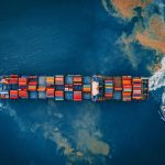
The oceans, seas and coastal areas play a large role in the fight towards food security and eliminating poverty. It’s estimated that just under half the world’s population lives in or near coastal areas and 80% of world trade is conducted thanks to the seas. In fact, more than 3 billion people make their living via the oceans.
However, despite their importance, oceans continue to be severely threatened by human activities that sacrifice the environment to make a profit.
Illegal activities at sea, whether it is fishing, pollution, or illegal trafficking, have devastating economic and environmental effects. Not only are our oceans affected in their integrity, but often the local communities are deprived of an essential resource for their survival by being denied their traditional fishing activity. Pollution, climate change, and marine habitats degradation alter ocean-based industries worldwide.
In the framework of the Copernicus program of the European Commission, CLS has been associated since 2012 as the prime contractor of the SAR Mission Performance Cluster (SAR-MPC). The SAR-MPC project ensures that the images generated by the Sentinel-1 SAR constellation achieve the targeted performances for the benefit of their users.
Those performances allow inter alia to address the applications related to monitoring of maritime domain, and detection of illegal activities.
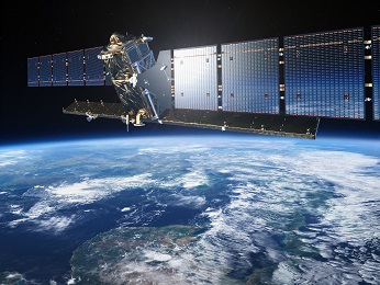
Sentinel-1 satellite
From the beginning, CLS has been involved in the Sentinel -1A mission
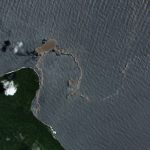
With the Sentinel-1 constellation and CLS’ expertise, we can observe the Earth and get radar images of any place in the world. The Sentinel-1 satellites have already demonstrated their ability to be reprogrammed in an emergency, such as a major event affecting a region. Sentinel-1A is used to monitor our maritime space, detect oil slicks, help track vessels, fight against illegal trafficking (illegal fishing, piracy, etc.), understand ocean evolutions and support authorities in case of natural disasters.
As a technical top-level expert, we ensure the performance of the SAR Sentinel-1 mission, lead and animate the community of European experts in the field and we control the performance from start to finish: instrument adjustment, development of ground processing tools, performance verification (radiometry, geometry, geophysical inversion…).
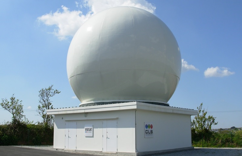
VIGISAT French station
CLS, the first French collaborative sentinel-1 receiving station
In operation since 2012, CLS’s VIGISAT station, based in Brest (France), receives images from the Sentinel-1 satellite constellation. VIGISAT was the first French collaborative station and continues to provide data and products with near real-time positioning services and sea states measurements for maritime surveillance applications.
Sentinel-1 Mission Performance Cluster
CLS contributed to the development of S-1 processor through the conception and development of Ocean level-2 products to measure sea surface conditions, as well as sensor performance monitoring under the “Sentinel-1 Mission performance Centre” (MPC- S1), located in CLS Brest, France. CLS manages and operates the Sentinel-1 Mission Performance Cluster in partnership with top-level experts Aresys, DLR, IFREMER, NORCE, Ocean Data Lab and S&T.
For CLS it is also a win-win operation: maintaining and developing expertise, better technical mastery, we are proud and honored to collaborate in this EU/ESA project. The initial contract was extended and renewed in 2021. The project is ongoing until the end of 2026.
Key Figures
- 14 year-long project.
- Verification, calibration and validation of 3 satellites (2 launched, 1 out of service, and 1 to be launched in 2023).
- 874 Technical Reports transmitted to our customers in 10 years. On average, one report every 4 days, not counting automatic reports.
- 47 versions of processing systems/processors delivered (including validation version).
- 3,500 images verified automatically per day.
- 650 of which are verified by visual inspection by our operators. In total they have visually scanned the surface of the Earth more than 250 times.
- Number of images generated by ESA with our performance verification: 24 petabytes.
The SAR Mission Performance Cluster service is funded by the EU and ESA.

![]()
![]()
The views expressed herein can in no way be taken to reflect the official opinion of the European Space Agency or the European Union.