← Back
Satellite Oil Spill Detection in Gabon: How CLS Supports Marine Pollution Investigations

Satellite oil spill detection in Gabon was requested after an environmental organisation reported a potential hydrocarbon slick offshore.
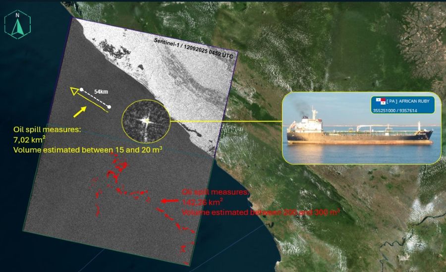
CLS analysed the event using Sentinel-1 radar imagery and AIS vessel data to characterise the spill, measure its extent, and assess whether vessel activity in the area could be linked to the pollution.
Detection of a Large Oil Slick
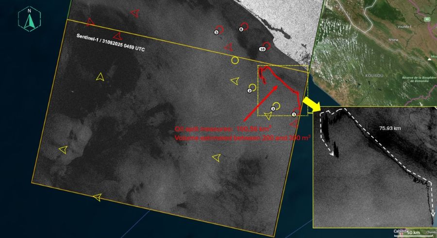
A Sentinel-1 radar acquisition revealed a hydrocarbon slick measuring 100.56 km².
According to CLS analysts, this corresponds to an estimated volume of 200–300 m³, based on standard thickness models for fresh oil films at sea.
A distinctive curve in the slick’s shape, clearly visible in the radar scene, was identified by the analysts as a manoeuvre pattern frequently associated with operational discharges. This interpretation is based on expert knowledge and not a direct measurement.
Satellite Oil Spill Detection in Gabon: AIS Activity Analysis
AIS data showed no vessel broadcasting near the slick at the relevant time.
Several vessels detected by radar without AIS appear on the image, and others broadcasting AIS appear separately. According to the analysts, none of these vessels matched the position or timing of the slick.
Based on this lack of correlation, the analysts consider that the discharge may have been carried out by a vessel not transmitting AIS at that moment. This interpretation remains analytical rather than proven.
Despite the absence of AIS, radar imagery provides independent evidence of the pollution, enabling authorities to document environmental incidents that would otherwise remain undetected.
Monitoring the Evolution of the Slick
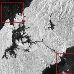
A subsequent Sentinel-1 image taken several days later showed the slick spreading over 75.93 km.
As explained by the analysts, such dispersion is consistent with a reduction in film thickness, from 2–3 mm shortly after release, to around 1 mm after several days.
The estimated volume remains consistent with the initial assessment, supporting the conclusion that both observations correspond to different phases of the same pollution event.
A second scene reveals a different case, and a responsible vessel
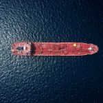
A subsequent Sentinel-1 acquisition revealed an additional slick.
This time, the slick was directly correlated with a vessel emitting AIS, the only ship in the vicinity and aligned with the observed pollution.
The attribution was clear, supported by radar detection, AIS trajectory and the absence of alternative candidates.
This demonstrates how CLS combines space-based detection with vessel tracking to identify polluters when possible, and exclude innocent ships when necessary.
Enhancing Marine Protection With Satellite Intelligence
Across all observations, CLS used Sentinel-1 radar and AIS activity analysis to:
- Detect hydrocarbon slicks with high reliability
- Quantify surface areas and estimate volumes
- Track the evolution of slicks over time
- Identify or exclude vessels when data allows
- Provide trusted, objective evidence to support authorities in marine pollution investigations
Satellite oil spill detection in Gabon demonstrates how space-based maritime surveillance strengthens environmental monitoring and helps coastal states and NGOs better protect their waters.