← Back
CLS analysts investigate oil spill off Corsica from space

Thanks to satellite data, the 3 polluting slicks are clearly identified, located, and their size calculated.
An oil spill has been detected at sea just East of Corsica, visible on the radar satellite images received, processed and studied by CLS analysts, experts in pollution response.
This pollution, containing heavy hydrocarbons, is divided into three slicks over a total length of 66 km. The different slicks are currently located 15 km from the coast.
CLS analysts are currently using their back-drifting tools to try to identify the potential offender of this pollution that is typically characteristic of illegal degassing.

CLS is the operator of the European CleanSeaNet service run by EMSA, the European Maritime Safety Agency (EMSA). This program aims to support European states in the fight against pollution using satellite and UAV data.
In 10 years, the EMSA service operated by CLS for the member states has enabled them to halve oil pollution in European waters.
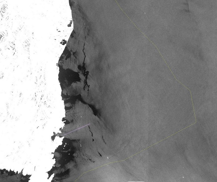
Image taken by the ESA Sentinel-1 satellite, received by the CLS VIGISAT station on Saturday 12 June at 7:25 UTC, processed and analyzed by CLS experts in pollution detection.
Copyrights: CLS, Copernicus/Sentinel, ESA